
By Jett Whittington, The Alliance Gazette
Evening outlook issued Thursday, October 15, 2026, for Friday, October 16, and Friday night into Saturday morning, October 17. National Weather Service point forecasts updated at 1:26 p.m. CDT October 15 and checked at 5:28 p.m. CDT. Forecasts and county alerts rechecked at 5:58 p.m. CDT, with Friday forecast values unchanged. All times below are Central Daylight Time.
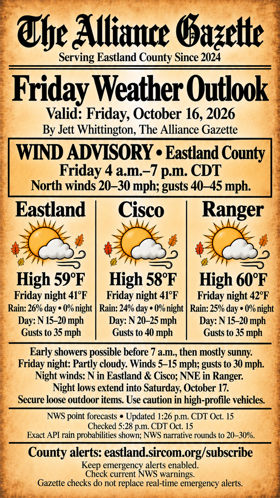
Friday brings a sharp cool-down and strong north winds to Eastland, Cisco and Ranger. Early showers remain possible before 7 a.m., followed by mostly sunny skies. Highs are forecast near 58–60°F, with Friday-night lows near 41–42°F.
Tonight: Flood Watch through 1 a.m. Friday
Separate from Friday’s daytime outlook, a Flood Watch is in effect for Eastland, Jack, Montague, Palo Pinto, Stephens and Young counties through 1 a.m. CDT Friday, October 16. Issued at 12:16 p.m. CDT October 15, it identifies possible flooding from excessive rainfall, with 1–2 inches most likely and isolated totals up to 4 inches. A watch means flooding is possible; it does not confirm flooding or damage. Monitor later forecasts and possible Flood Warnings. Never drive through flooded roads.
Wind Advisory: Friday 4 a.m.–7 p.m.
The National Weather Service Fort Worth office has issued a Wind Advisory that includes Eastland County and much of North and Central Texas for Friday, October 16, from 4 a.m. to 7 p.m. CDT. The advisory calls for north winds of 20–30 mph and gusts of 40–45 mph across its area. These are expected conditions, not reports of damage.
Secure trash cans, patio furniture and other lightweight outdoor items. High-profile vehicles may be difficult to handle, especially in crosswinds. Small limbs could break; use extra caution on area lakes. The county-wide advisory describes a broader area than the individual town-point forecasts below.
The advisory was issued at 12:18 p.m. CDT October 15. Its current bulletin expires at 1 a.m. October 16; the stated weather-event window runs through 7 p.m. Friday. Check for replacement bulletins and current warnings before traveling.
Eastland
Friday: High near 59°F. A chance of showers before 7 a.m., then mostly sunny. North winds 15–20 mph, gusting to 35 mph. The NWS numeric forecast gives a 26% precipitation probability; its narrative rounds that to 30%.
Friday night into Saturday morning: Low near 41°F; partly cloudy. North winds 5–15 mph, gusting to 30 mph. Precipitation probability: 0%.
Cisco
Friday: High near 58°F. A slight chance of showers before 7 a.m., then mostly sunny. North winds 20–25 mph, gusting to 40 mph. Numeric precipitation probability: 24%; the NWS narrative rounds that to 20%.
Friday night into Saturday morning: Low near 41°F; partly cloudy. North winds 5–15 mph, gusting to 30 mph. Precipitation probability: 0%.
Ranger
Friday: High near 60°F. A chance of showers before 7 a.m., then mostly sunny. North winds 15–20 mph, gusting to 35 mph. Numeric precipitation probability: 25%; the NWS narrative rounds that to 30%.
Friday night into Saturday morning: Low near 42°F; partly cloudy. Temperatures may rise toward 44°F overnight. North-northeast winds 5–15 mph, gusting to 30 mph. Precipitation probability: 0%.
Forecast periods and sources
Daytime values cover 6 a.m.–6 p.m. Friday, October 16. Nighttime values cover 6 p.m. Friday–6 a.m. Saturday, October 17. These are Friday-night lows, not Thursday-night lows. The graphic uses the exact NWS API precipitation probabilities; official narrative percentages are rounded, as noted above. Forecasts can change, and conditions vary away from each representative town point.
Official NWS point forecasts: Eastland; Cisco; Ranger. Current Eastland County alerts. NWS Fort Worth forecasts and warnings.
Keep real-time alerts enabled
Sign up for the official Eastland County Alert System, as linked by the county emergency-alerts page. Keep emergency alerts enabled on your phone and check current NWS warnings. Gazette forecast checks do not replace real-time emergency alerts; the Gazette is not a real-time alert service.