By Jett Whittington, The Alliance Gazette
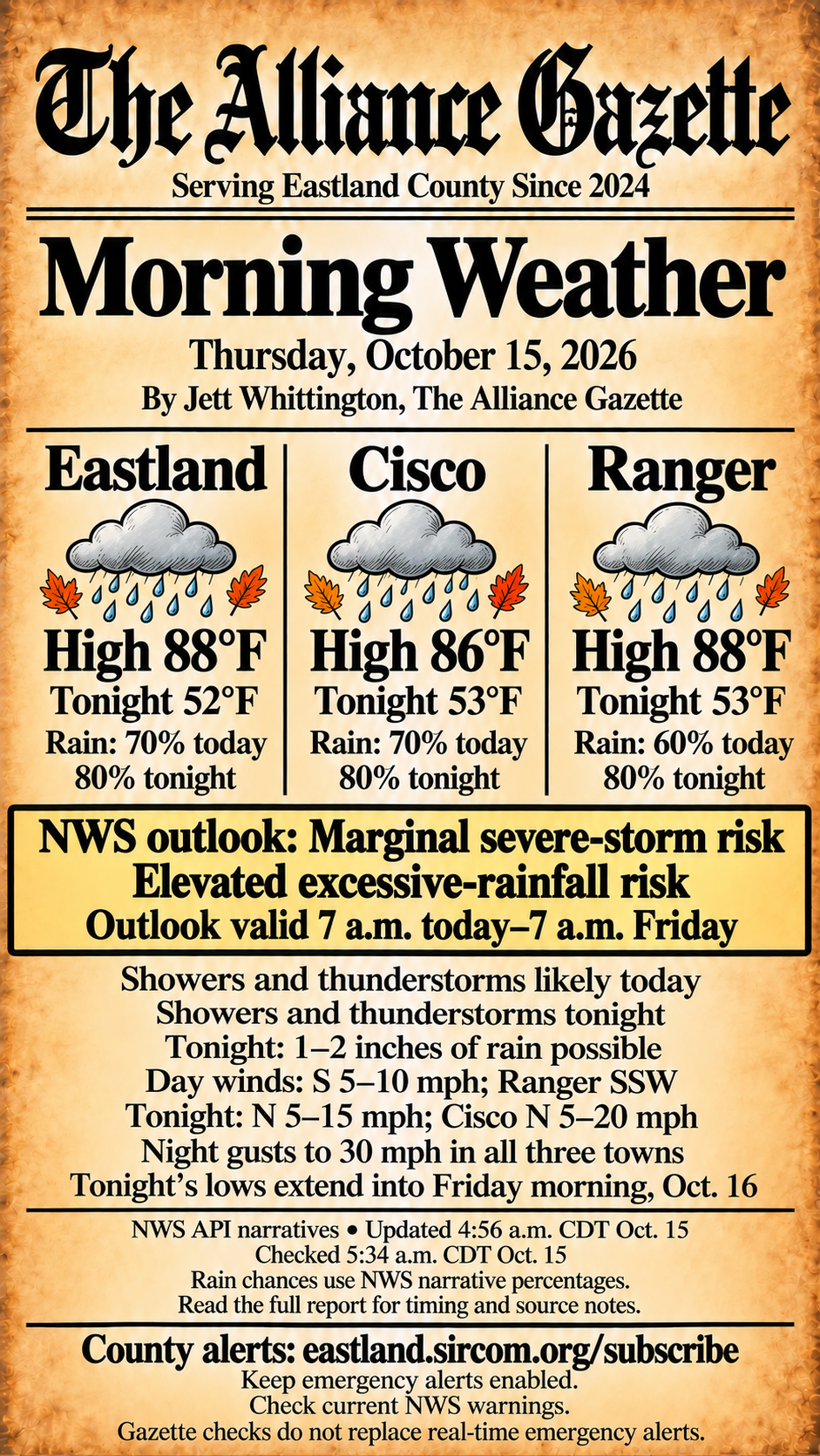
Thursday, October 15, 2026. Showers and thunderstorms are likely today in Eastland, Cisco and Ranger, with rain continuing tonight as a cold front brings cooler temperatures and gusty north winds. Highs are forecast in the middle to upper 80s; tonight’s lows fall into the lower 50s.
Storm and heavy-rain outlook
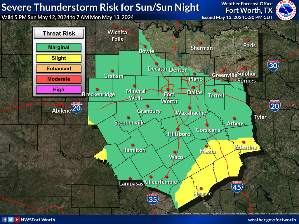
The National Weather Service Fort Worth graphical outlook maps, generated at 5:07–5:08 a.m. CDT, place Eastland County in a marginal severe-thunderstorm risk and an elevated excessive-rainfall risk for 7 a.m. Thursday through 7 a.m. Friday. These are outlook categories, not active warnings or confirmation that damaging weather will occur. Stronger storms and locally heavy rain are possible; monitor current warnings and do not drive through flooded roads.
Forecasts and the graphic above use the NWS API point-forecast narratives updated at 4:56 a.m. CDT and checked at 5:34 a.m. CDT. The NWS public forecast pages agree on temperatures and rounded rain chances but differ on some timing, wind and rainfall details, explained below. Rainfall amounts are possibilities, not observed totals or guarantees.
Eastland
Today: Partly sunny, with a high near 88°F and temperatures falling toward 80°F in the afternoon. A chance of showers and thunderstorms early, then storms likely. Rain chance 70%. South wind 5–10 mph. The API narrative forecasts ½–¾ inch of new rain possible.
Tonight: Cloudy, with showers and thunderstorms and a low around 52°F. Rain chance 80%. North wind 5–15 mph, with gusts to 30 mph in the API narrative. New rainfall of 1–2 inches is possible in that product.
Cisco
Today: Partly sunny, with a high near 86°F, falling toward 78°F in the afternoon. Showers and thunderstorms likely after an early chance; some storms could produce heavy rain. Rain chance 70%. South wind 5–10 mph. New rainfall of ½–¾ inch is possible.
Tonight: Cloudy, with showers and thunderstorms, possible heavy rain and a low around 53°F. Rain chance 80%. The API narrative has north wind 5–20 mph and gusts to 30 mph. New rainfall of 1–2 inches is possible.
Ranger
Today: Partly sunny, with a high near 88°F, falling toward 80°F in the afternoon. Showers and thunderstorms likely after an early chance. Rain chance 60%. The API narrative has south-southwest wind 5–10 mph. New rainfall of ¼–½ inch is possible.
Tonight: Cloudy, with showers and thunderstorms and a low around 53°F. Rain chance 80%. North wind 5–15 mph, with gusts to 30 mph in the API narrative. New rainfall of 1–2 inches is possible in that product.
Period note: Today’s forecast covers 6 a.m.–6 p.m. CDT October 15. Tonight covers 6 p.m. October 15–6 a.m. Friday, October 16. These lows are for Thursday night into Friday morning, not the overnight period ending this morning.
Why the official forecast pages differ
Both the API and the public NWS forecast pages show the same 4:56 a.m. update. The public pages emphasize rain mainly after 4 p.m. today. For Eastland and Ranger, those pages show tonight’s gusts to 25 mph and ¾–1 inch of rain, compared with 30 mph and 1–2 inches in the API narratives used on the graphic. For Cisco, the public page has north wind 5–15 mph tonight, compared with 5–20 mph in the API; both have gusts to 30 mph and 1–2 inches possible.
The public Eastland page has ¼–½ inch of rain today, compared with ½–¾ inch in the API. Ranger’s public page describes today’s wind as south rather than south-southwest. Public-page timing favors storms before 10 p.m. in Eastland and Ranger, then diminishing shower chances overnight; Cisco’s storm chances continue through 1 a.m. The API narratives describe the night more broadly. These differences add uncertainty to exact amounts and timing. Check the latest official forecast for your location.
Rain percentages above are the rounded percentages in the API’s detailed narratives. The underlying probability fields are 65%/83% for Eastland, 69%/83% for Cisco and 64%/80% for Ranger, today/tonight.
Stay connected to real-time alerts
The Eastland County and forecast-zone feeds returned no active NWS watches, warnings or advisories at the 5:58 a.m. CDT pre-publication check. That is a timestamped feed result, not an all-clear; the storm and heavy-rain outlook still applies. All three point forecasts, public forecast pages and the outlook maps were also rechecked at 5:58 a.m. CDT and were unchanged.
Sign up for official Eastland County emergency alerts, verified through the county’s Emergency Alerts page. Keep emergency alerts enabled on your phone and check current NWS warnings. Gazette checks do not replace real-time emergency alerts.
Official sources
- Eastland NWS API forecast · Public point forecast
- Cisco NWS API forecast · Public point forecast
- Ranger NWS API forecast · Public point forecast
- NWS Fort Worth graphical hazardous-weather outlook · Severe-thunderstorm outlook · Excessive-rainfall outlook
- Eastland County active alerts · Eastland forecast-zone active alerts